Measuring a Field, Yard, or Plot of Land With Nothing but a Phone
A practical look at how a GPS area measurement app works out acreage, distance, and awkwardly shaped plots without calling a surveyor, unspooling a tape measure, or paying for a subscription.
Get this app
About this app
Maybe you just closed on a plot of land, or you're finally getting around to fencing the yard, and the paperwork hands you a number in acres that means nothing until you're standing on the property trying to picture it. A tape measure handles a rectangular backyard fine, but the second a boundary bends around a creek or climbs a slope, hand measurement stops being realistic - and calling a surveyor feels like overkill for a number you just need today.
What this app is actually measuring
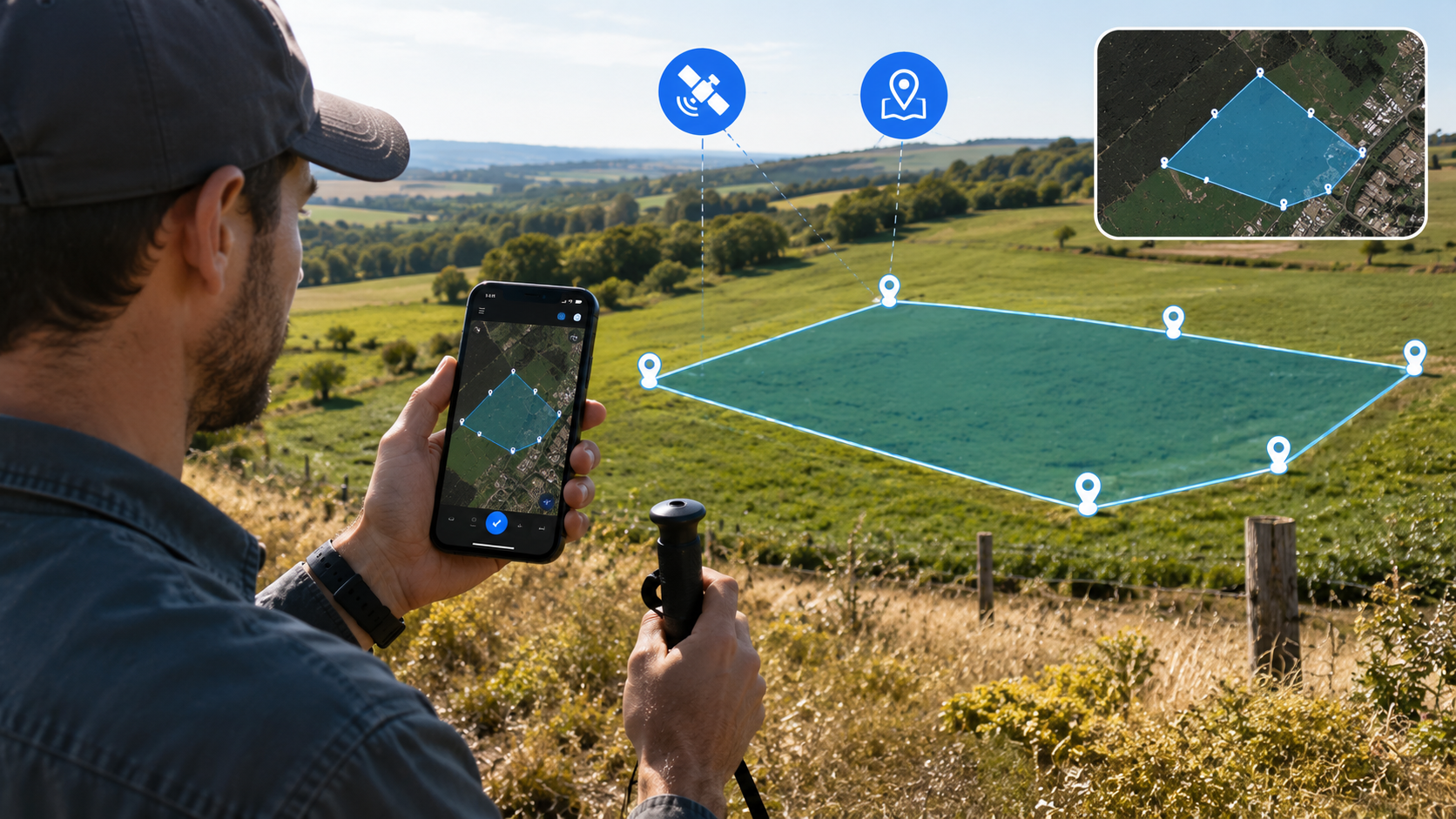
FieldCalc - GPS Area Measure leans on your phone's GPS to work out the area and perimeter of a piece of land, either by tracing it over a satellite map or by walking the boundary while the app tracks your position. It's the same core idea a land surveyor relies on, minus the equipment and the invoice. Under the hood, the app drops a series of coordinate points around the shape you trace and runs a standard area formula against them - the same math a planimeter has used for over a century, just automated and shrunk down to fit in your pocket.
A couple of ways to trace a boundary
- Map trace – zoom into satellite view, drop pins along the edges of the plot, and let the app close the shape and work out the area. The quickest route when the boundary is visible from above.
- Walk mode – walk the perimeter with the phone in hand while the app logs your GPS track, useful when tree cover, fencing, or terrain hides the boundary from satellite imagery.
- Manual entry – key in known distances and bearings if you already have survey figures and just want the area computed.
- Hybrid correction – rough out a trace on the map first, then nudge individual points by hand to match what you actually see on the ground.
Getting a reading you can trust
Phone GPS usually lands within a few meters under open sky, which is plenty for a field or a large lot but worth factoring in on a small yard, where a few meters of drift can shift the number noticeably. A handful of habits make a real difference in how closely the app's figure tracks a professional survey.
- Step 1 – Give the GPS a moment to settle. Open the app and wait 10-15 seconds before starting a trace so it locks onto a strong signal instead of a rough first guess.
- Step 2 – Walk the actual edge, not the convenient one. In walk mode, stay directly on the boundary line rather than cutting corners around obstacles.
- Step 3 – Stay clear of heavy tree cover and tall buildings. Both block or bounce GPS signals, and that is where accuracy takes the biggest hit.
- Step 4 – Close the loop properly. Make sure your start and end points connect; leave the boundary open and the area calculation gets thrown off.
- Step 5 – Run a second pass to cross-check. Retracing the same boundary and comparing the two figures is a fast way to catch a bad GPS read before trusting the number.
What it is genuinely good for
- GPS-based area measurement – trace or walk a boundary and get an area figure without measuring a single stretch by hand.
- Acreage calculator – convert raw area into acreage on the spot, useful for comparing land listings or planning out a farm.
- Distance and perimeter tools – measure fence lines, paths, or property edges independently of the total area.
- Planimeter mode – handles irregular, non-rectangular shapes that a simple length-times-width formula would botch.
- Offline functionality – keep measuring out in a field with zero signal, then sync once you are back in range.
How the methods compare
| Method | Best for | Main limitation |
|---|---|---|
| Map trace | Open, visible plots | Satellite imagery can be outdated |
| Walk mode | Wooded or obstructed boundaries | Slower, depends on live GPS signal |
| Manual entry | Plots with existing survey data | Requires you to already have the figures |
| Professional survey | Legal or high-stakes transactions | Cost and scheduling |
Who this is actually for
This one has real scale behind it - over 10 million downloads and nearly 170,000 reviews at a solid rating, which is a lot of trust for a niche measurement tool. It carries ads and in-app purchases, and it is rated for all ages, but the actual audience is fairly specific: farmers sizing up crop fields, landscapers quoting a job, real estate agents walking a property with a client, and homeowners who just want to know what they actually own.
It is worth being clear about what this kind of app is not. A GPS reading on a phone is a strong working estimate, not a legal survey, and anything tied to a property line dispute, a permit application, or a real estate closing still needs a licensed surveyor's stamp. For day-to-day decisions - how much seed to order, how much fencing to buy, whether a listed acreage roughly checks out - the phone number is close enough to act on.
For anyone who needs a land area figure today rather than after a surveyor's callback, this kind of GPS measurement app gets you a workable number fast, and the offline mode means a weak signal out in a field will not stop you halfway through.