
The Fastest Way to Pull Up Your Exact GPS Coordinates
My GPS Coordinates & Tracker surfaces your latitude, longitude, and location history in seconds - a look at what it offers hikers, travelers, and anyone who needs precise coordinates on the move.
Get this app
About this app
Try telling a friend exactly where you're standing using nothing but vague landmarks - the big rock past the river bend, say - and you'll quickly see why coordinates exist. GPS Coordinates & Tracker is built for the moment you need actual numbers instead of a vague description - hiking an unmarked trail, marking a campsite, or sending someone your precise latitude and longitude instead of a fuzzy pin drop.
The basic idea
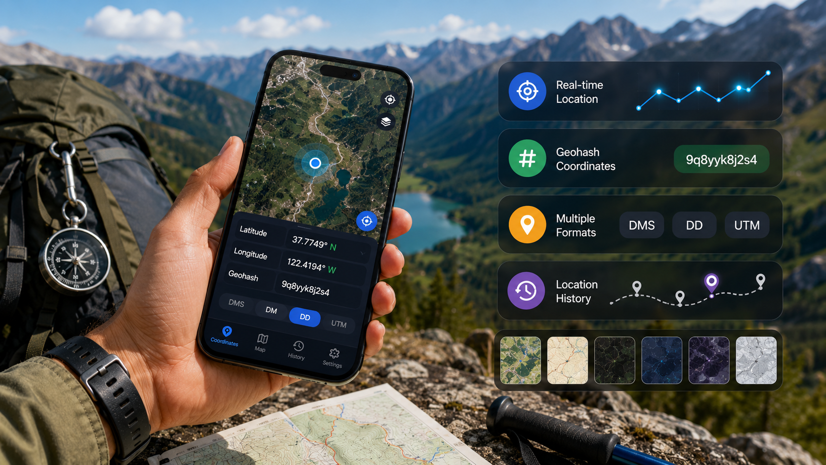
Open the app and your current coordinates appear right away, no digging through settings or switching to a separate map app. You get your position as standard latitude and longitude, plus a geohash version if you want something compact enough to fit in a text message, and there's a full interactive map underneath so you can actually see where you are rather than just staring at numbers. There's no account to create and no onboarding to click through - it asks for location permission once and then stays out of your way.
Features beyond the basics
- Live location updates – your latitude and longitude refresh in real time as you move, no manual refresh required.
- Geohash coordinates – a compact code version of your location that's simpler to copy and share than a long decimal string.
- Several coordinate formats – toggle between Degrees Minutes Seconds (DMS) and UTM depending on whether you want something casual or closer to surveying-grade precision.
- Seven map styles – Standard, Terrain, Retro, Dark, Night, Aubergine, and Silver, so there's something legible in bright sun or after dark.
- Location history – previous locations and routes stay stored on your device, so you can revisit where you've been.
- One-tap sharing – push your current coordinates straight into a messaging app or copy them to the clipboard without retyping a thing.
- Offline map caching – map tiles you've already loaded stick around even after you lose signal, which counts for more in the woods than anywhere else.
Getting your first reading
- Allow location access – the app asks for GPS permission on first launch; approve it once and it remembers your choice going forward.
- Give the fix a moment – wait a few seconds outdoors for the GPS signal to lock in, since indoor readings tend to be less accurate.
- Choose a format – tap the coordinate display to cycle through decimal degrees, DMS, UTM, or geohash.
- Save it or send it – bookmark the point for later, or share it with someone else right away.
The formats side by side
| Format | Looks like | Best for |
|---|---|---|
| Decimal degrees | 37.4219, -122.0840 | Pasting into Google Maps or GPS devices |
| DMS | 37°25'19"N 122°05'02"W | Reading aloud or matching paper maps and compasses |
| UTM | 10S 583960 4142051 | Surveying, engineering, or technical fieldwork |
| Geohash | 9q9p1 | Texting a location fast without losing precision |
Who this is actually for
Most people don't need raw coordinates on a daily basis, but a specific slice of users run into this need constantly: hikers marking a trailhead or campsite so they can find it again next season, travelers who need to hand a taxi driver or delivery service an exact pin instead of a mangled street address, and surveyors, drone pilots, and outdoor workers who already think in UTM or DMS and don't want to convert by hand. And really, anyone who's ever tried to describe a meeting spot in a parking lot with no address to point to.
It runs on ads with in-app purchases available, which is par for the course for a free coordinates tool, and carries an all-ages rating. What stands out in the app's own listing is the privacy stance - it states location data stays on-device and isn't shared without consent, which counts for more than usual on an app whose entire job is tracking exactly where you are. With over 100K downloads and a 4-star rating from more than 2,400 reviewers, it's clearly getting the fundamentals right for a wide mix of users, from casual travelers to people who need DMS or UTM for more technical work.
What it doesn't do
This is a focused utility, not a navigation suite - don't expect turn-by-turn directions, offline vector maps of whole regions, or route planning. Accuracy also rides entirely on your phone's GPS chip and how much sky it can see, so readings indoors or in dense urban canyons will drift more than they would out in the open. If you need routing on top of coordinates, pair this with a dedicated navigation app rather than expecting it to double as one.
Whether you're deep in the woods with no signal or just need to drop an exact coordinate into an email, this is a lightweight way to get there without wrestling a bulkier navigation app into giving you a straight answer.
Why There Are Four Ways to Write Down the Same Spot
It's a fair question why a single location needs four different notations. Each one grew out of a distinct practical need: decimal degrees are what modern digital mapping runs on internally, so pasting them into Google Maps or a GPS unit just works. DMS predates digital mapping altogether and matches how a physical compass and paper chart describe a position, which is why sailors and hikers using traditional gear still reach for it. UTM is a grid-based system built to measure distance accurately across large areas, which is why surveyors and engineers rely on it. Geohash is the newest of the bunch, purpose-built for squeezing a coordinate into a short string you can text or read aloud without losing meaningful precision. None of the four is objectively better - they're just solving different problems.
A Fast Gut-Check on Outdoor GPS Accuracy
- Open sky delivers the tightest fix, often accurate to within a few meters - a clearing, a beach, or an open field is where a reading is most trustworthy.
- Thick tree cover and narrow canyons between tall buildings both hurt accuracy noticeably, since the signal ends up reflecting and scattering instead of arriving clean.
- Give the app ten to fifteen seconds to settle after opening it outdoors rather than trusting the very first number it shows - that patience usually buys a more reliable fix.