
Ever Wondered What Your Old House Looks Like From Orbit? This Satellite Map App Shows You
A satellite map app that bundles live Earth imagery, 3D street view of famous landmarks, nearby-place search, and everyday GPS tools into one place, handy whether you're planning a trip or just curious what your own street looks like from space.
Get this app
About this app
There's a very particular kind of late-night curiosity where you open a map app for no navigational reason at all - you just want to see what the Eiffel Tower looks like from orbit, or check whether the tree out front of your childhood home is still standing. That itch is basically the whole reason this app exists.
A Satellite Map App Juggling More Than One Job
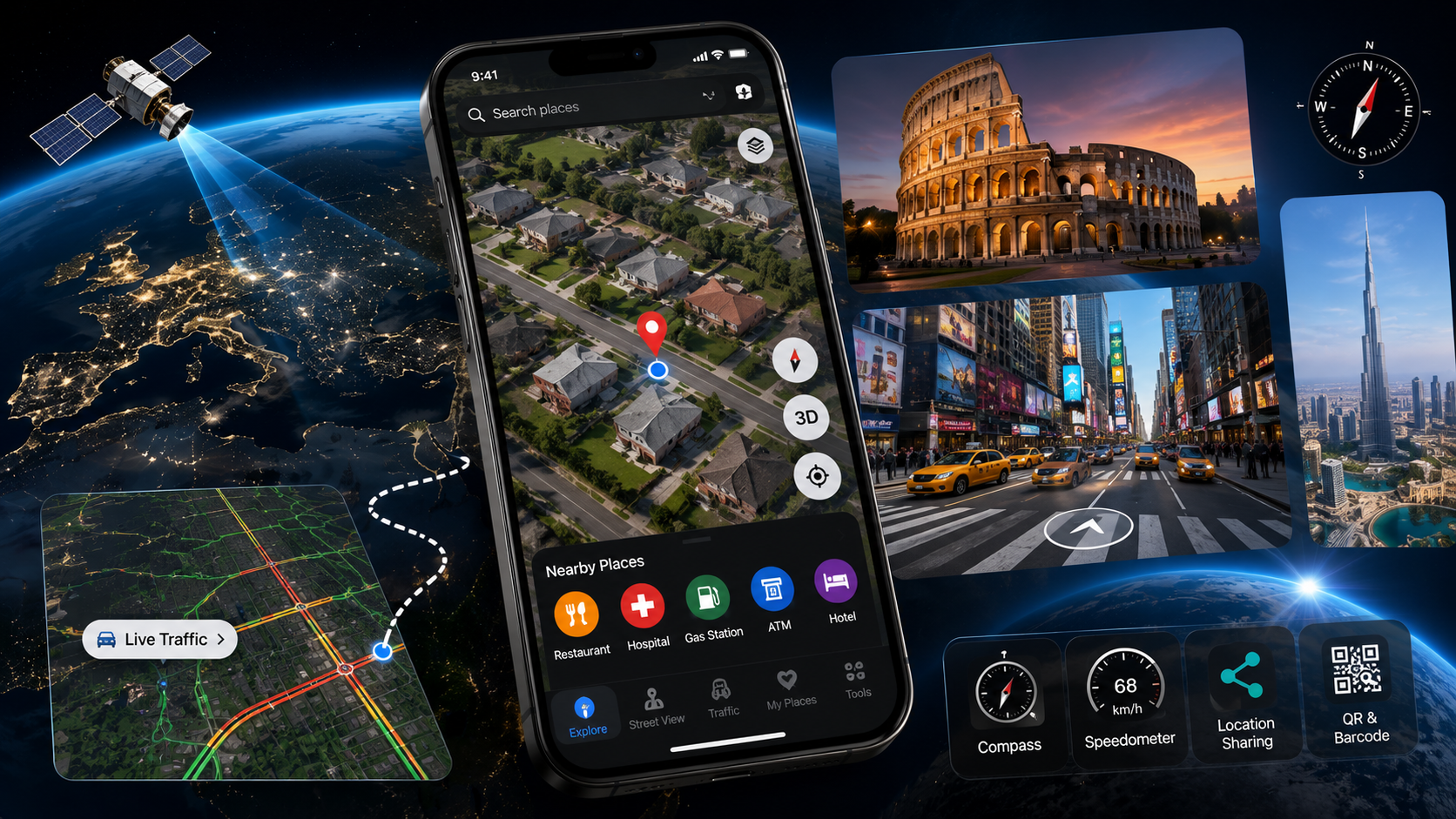
Live Earth Map 3D: Satellite is really answering two different needs at once. One half is a genuine exploration tool - satellite imagery you can zoom deep into, plus 3D street view of famous landmarks and tourist spots worldwide. The other half is a practical navigation sidekick: nearby places, live traffic, and a set of GPS tools that would ordinarily be spread across three separate apps. Rather than juggling a maps app, a compass app, and a speedometer app on a road trip, it's all sitting behind one icon.
What's Actually Packed In
- Detailed satellite and live Earth maps: zoom into cities, coastlines, and landmarks through live satellite imagery instead of a flat, static tile.
- 3D street view of famous places: walk through iconic landmarks and tourist destinations virtually, no plane ticket needed.
- Nearby place search: hospitals, ATMs, gas stations, restaurants, and hotels pinned directly on the map around wherever you are.
- Live traffic overlay: check road conditions before you leave so you're not the one person blindsided by a closure.
- Journey tracking: log distance, route, and duration while you travel, handy if you like keeping a record of your trips.
- Everyday GPS extras: a built-in compass, speedometer, location sharing, and a QR and barcode scanner all tucked into the same app.
Getting the Most Out of It
- Start somewhere you already know: search your own street or hometown first so you have a baseline for how sharp the imagery actually gets when you zoom in.
- Switch to 3D street view for landmarks: this is where the app earns its download, not the flat satellite tiles you can find anywhere.
- Turn on traffic before you drive, not during: it's more useful as a pre-trip check than something you glance at mid-journey.
- Save the compass and speedometer for outdoor use: hiking, boating, or anywhere a phone GPS beats hauling dedicated gear.
- Lean on nearby-place search in unfamiliar cities: it's quicker than typing out a specific address when you just need the closest ATM or gas station.
Where It Fits Alongside Other Map Apps
| Need | Better fit |
|---|---|
| Turn-by-turn driving directions | A dedicated navigation app |
| Zooming into satellite imagery for curiosity or planning | This app |
| Virtual walkthroughs of famous landmarks | This app |
| Checking traffic before leaving | This app |
| Compass, speedometer, and QR scanning without extra installs | This app |
| Offline maps for areas with no signal | A dedicated offline-maps app |
A Couple of Caveats Worth Flagging
This is a newer listing - just over a thousand downloads so far and no public rating yet, so anyone trying it now is ahead of most reviewers rather than behind them. The app is upfront that satellite imagery, traffic data, and nearby-place results depend on region and network connection, so accuracy swings more in less-mapped areas than in a major city. It carries ads and in-app purchases, and holds a 3+ rating.
Worth keeping in mind: this isn't a substitute for turn-by-turn navigation on an actual drive, and it's not built for offline use where there's no signal. Think of it as the app you open before a trip to scout a destination, or the one you pull up purely out of curiosity, rather than the one running in your car mount for every commute.
As a single app covering both idle world-exploring and real trip navigation, it manages both without much fuss - just go in knowing it's still building its track record.
Why 'Live' Satellite Imagery Isn't Quite Live
This is worth understanding since the app markets itself around "live Earth" imagery: satellite maps in consumer apps are almost never truly real-time. What you're actually looking at is a mosaic of recent satellite passes - some weeks old, some considerably older in less-visited regions - stitched together into one continuous map. A busy city center gets refreshed fairly often; a remote coastline might be showing imagery from years back. That's not a flaw unique to this app, it's how satellite mapping works across the entire industry, but it explains why your own street might look a little dated, or why a newly built structure hasn't shown up yet.
Better Uses for the 3D Landmark Views Than Just Curiosity
- Trip planning: get a real sense of a landmark's scale and surroundings before you arrive, something flat photos rarely capture well.
- School projects and travel writing: a quick virtual walkthrough beats describing a place secondhand off a couple of static photos.
- Deciding if a destination is worth the detour: viewing the actual site from multiple angles sets more realistic expectations than one hero photo found online.